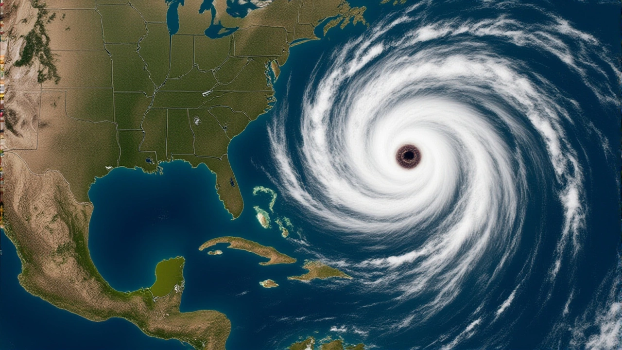
Coastal residents across the United States are being put on alert for a potential surge in "sunny day" flooding this year. National Oceanic and Atmospheric Administration (NOAA) announced on May 15, 2026, that a developing El NiñoUnited States climate pattern is expected to amplify existing sea level rise, creating what experts call a dangerous "double whammy." The National Weather Service predicts these conditions will emerge by July 2026 and persist through the winter of 2026–2027.
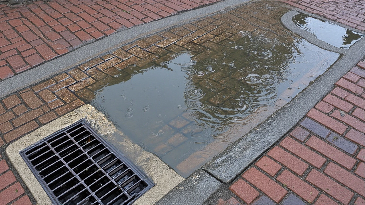
Here’s the thing: you don’t need a hurricane or heavy rain for your street to flood anymore. High tide flooding—often dismissed as "nuisance flooding"—is already a chronic issue for low-lying areas. But when El Niño kicks in, it raises baseline water levels significantly. Combine that with decades of steady sea level rise, and the result is water spilling over seawalls and onto roads during regular high tides. For many communities, this isn't just an inconvenience; it's a growing infrastructure crisis.
The "Two Punches" of Coastal Flooding
To understand why 2026 looks particularly risky, we have to look at how oceanographers view the threat. William Sweet, NOAA oceanographer, describes the situation using a boxing analogy. "The first punch," he explains, is the slow, relentless rise of global sea levels over the past few decades. This has left waters in many coastal towns "close to the brim."
"The second punch" is a strong El Niño event. When these two forces collide, the impact is compounded. Sweet points to historical precedents like the intense El Niño episodes of 2015–2016 and 2023–2024. During those periods, the U.S. saw a dramatic spike in flood frequency. It wasn't just about higher water; it was about how often the water breached the shoreline. With another strong El Niño forecasted, communities along both the West and East Coasts should brace for more frequent, deeper, and widespread inundation.
Historical Precedents and Scientific Backing
This isn't just theoretical forecasting. Science backs up the connection between El Niño and increased tidal flooding. A peer-reviewed study published in the Journal of Geophysical Research: Biogeosciences analyzed the 2015–2016 El Niño event. Researchers found substantial increases in tidal wetland flooding along the Atlantic and Gulf Coasts. The data showed that even without storms, the altered ocean currents and atmospheric pressure associated with El Niño pushed water levels high enough to saturate ecosystems and disrupt local infrastructure.
Resources from the Georgetown Climate Center’s Adaptation Clearinghouse reinforce this, noting that high tide flooding impacts roads, beaches, parks, and private property daily. While often less damaging than storm surges, it is far more disruptive. Imagine trying to commute to work when your usual route is underwater every morning for three weeks straight. That’s the reality for many residents in places like Miami Beach, Charleston, and Seattle during peak El Niño years.
Tools for Preparedness
So, what can communities do? NOAA isn't just issuing warnings; they’re providing tools. The agency highlights the Coastal Inundation Dashboard, which offers real-time and forecast water level information. This allows city planners and emergency managers to see exactly where water is likely to pool.
Additionally, users can check the Monthly Outlooks to see daily flood likelihoods up to a year in advance. There are also Annual Outlooks that let you toggle between annual and decadal projections. These resources help answer critical questions: Will my basement flood next month? Should I elevate my parking garage entrance now? By leveraging these data points, communities can move from reactive cleanup to proactive planning.
What Lies Ahead for 2026
The timeline is clear. Between now and December 2026, El Niño conditions are expected to strengthen. This means the risk window opens in mid-summer and peaks during the winter months. For coastal businesses, this could mean insurance premiums rising and supply chain disruptions if ports face repeated closures due to high water.
For homeowners, it’s a reminder to review flood insurance policies and consider elevation strategies. The details of specific local impacts vary by geography, but the overarching trend is undeniable. As sea levels continue their upward climb, each El Niño event becomes a stress test for our coastal defenses. The question isn't if flooding will occur, but how well we’ve prepared for it.
Frequently Asked Questions
What is El Niño and how does it cause flooding?
El Niño is a recurring climate pattern characterized by warmer-than-average ocean temperatures in the equatorial Pacific. It shifts atmospheric circulation, which can push higher sea levels toward the coasts of the Americas. This results in higher tides and increased frequency of "sunny day" flooding, even without storms.
When is the predicted El Niño expected to peak?
According to NOAA’s National Weather Service, El Niño conditions are likely to emerge by July 2026 and continue through the winter of 2026–2027. The highest risk for flooding typically occurs during the winter months when storm activity and high tides coincide with elevated baseline sea levels.
Which U.S. regions are most at risk?
Both the West Coast and East Coast of the United States are expected to face increased risks. Low-lying areas in states like California, Florida, Louisiana, and New York are particularly vulnerable due to existing sea level rise and dense coastal development.
How can I check flood risks for my area?
You can use NOAA’s Coastal Inundation Dashboard for real-time water level data. Additionally, the Monthly and Annual Outlooks provide forecasts on flood likelihoods up to a year in advance, helping residents and planners prepare for potential inundation events.
Is this flooding different from storm surge?
Yes. Storm surge is caused by wind and pressure from hurricanes or nor'easters. High tide flooding, or "nuisance flooding," happens during normal high tides when sea levels are already elevated by long-term trends and climate patterns like El Niño. It can occur on sunny days with calm winds.
